Island in the Sky

Moab, Utah; 26 Sept, 2017


My new home for a few days - just North of Moab


Basically, just a parking lot - but convenient to Canyonlands NP, Arches NP, and Moab.  Hard to pass up a spot with a view of these incredibly red rocks, even if it is just off the highway! The park is on SR 191 just about a mile south of the SR313 turnoff to Island in the Sky - it's right at the Gemini Bridges Road turnoff ($15 night; 35 pull-thru and back-in spots with picnic benches; also a porta-potty and a dumpster).  Getting great Verizon signal (4g 2-3 bars).


A day of looking up and then down, down, down into the canyons


Canyonlands National Park consists of 3 parts divided by the Colorado and Green River: Island in the Sky looks down into the canyons (over a 1,000 feet) from a high plateau; The Needles is an area of the valley floor that wanders through massive rock spires; and The Maze - the least developed area with no services and no roads (good for an extended backcountry experience.

I spent the day driving and hiking in Island of the Sky.  It was a lovely sunny day, with only a light breeze.  I was amazed (and a bit appalled) at the number of people there!  All the scenic view points were crowded (all parking taken and folks parked illegally on the shoulder); the visitor center was a mad house!  So different from the last time I was here - probably 25-30 years ago.


The rock layers here are much older than at Goblin State Park  The oldest layer is almost 300 million years old!


Monitor and Merrimac Buttes


The La Salle Mountains loom in the far distance - notable because the next morning I woke up and they were dusted with snow!


I love old wormy wood - such and interesting texture!


Cyanobacterial soil - this incredibly fragile crust is composed of soil and  cyanobacteria filaments.  It traps moisture and helps prevent erosion.  A critical component of desert ecology that can be destroyed with a footprint.


Looking down at the Green River as it winds its way thru the canyons.  I was reminded of rafting through this exact section so many years ago (only then I was looking up).


The famous 'Horse shoe bend' - as seen from Dead Horse Point.


At maximum zoom, I can even make out a few rafters!


Back at camp, a beautiful sunset to end the day.


Goblin Valley–Dark Skies and lots of rocks

22 Sept, 2017: Goblin Valley State Park, Utah

Dark sky designation


Goblin Valley is a designated ‘dark sky’ area.  The nearest towns (light sources at night) are 35 and 50 miles away, making this area one of the darkest in the US (although it seems that all Dark Sky areas claim that!).  Nevertheless, I can testify that once the sun is down, you cannot see your hand in front of your face.  It’s black out.  While several nights have been overcast, I’ve had a few really clear nights and the sky view is outstanding!  Lots and lots of stars and a clear view of the Milky Way.  I think I read that 2/3 of Americans no longer have a view of the Milky Way from their homes – too much light pollution in the cities.  How unfortunate!!

One of these days I will have the patience to go through all my camera settings and set up a tripod to see if I can get a photo of the amazing night sky – but not yet.  The nights have been getting progressively colder and colder – my temp gauge is reading around 20F in the mornings – it may be getting a little wonky because that seems very cold – on the other hand, my furnace has been running a lot at night!!  Even the day time temps are chilly if I’m sitting in the shade (still T-shirt weather for hiking).

Wandering through the Valley of Goblins


What can I say?  I love all the weird shapes and the dramatic colors.


A duck?


"I found that I had more to say about the color blue" Georgia O'Keefe


Suspense! When will it fall??

Goblin Valley - Day 3

19 Sept, 2017; Goblin Valley State Park, Utah

The wind is howling today!!


Actually, it’s been all night too.  And, as I remember from my childhood in west Texas, when it’s windy, everything get coated with fine sand.  All my counters, the dinette, my upholstery, my bed – all covered with a very fine red grit.  The picnic table and my grill are covered too.

Fasten the stampede strap on my hat and go hiking . . .


I start out hiking the easy 2.1 mile Curtis Bench trail as it winds South along a section of exposed rock (Curtis layer).  From here, I can look down to the East and see the 3 distinct valleys that comprise Goblin Valley.  Basically, the Goblins are the eroded remains of the lowest level of rock (the Entrada layer).  It probably runs 2 or 3 miles south.


Campground from above


At the end of the Curtis bench trail, I find a great view of the distant Henry Mountains.  Coincidently, I caught a television show about them only last week.  Some hunters brought 18 bison from the Yellowstone herd to the Henry’s in the early 1940”s and now their population is over 200!  Hard to imagine bison living in the mountains, but they’re obviously doing quite well!


Entrada Canyon trail: On the way back from the Curtis Bench trail, I see a sign for the Entrada Canyon Trail.  It winds its way down drainage paths through a jumble of eroding rock before ending up on the floor of the Valley of Goblins.


I probably wouldn’t do this trail again – a lot of it was steep and very narrow (like barely a shoe width). The sides of these washes were a mix of sand and sandstone boulders and I couldn’t help wondering what would happen if, as I clambered over them, one of the boulders rolled (like that hiker in a slot canyon a few years ago whose arm got trapped when a boulder rolled). 


Also, while the signage was mostly adequate, it petered out near the bottom, causing me to have to check out a few blind turns as I wound my way out to the valley floor.  Not much chance at that point of getting stuck or lost – but a bit disconcerting.

Sometime cairns marked the way, sometimes a parkservice post with a little arrow; sometimes only the footprints of previous hikers.


Highlight of the Entrada Trail was this guy – I guess about 3.5-4’ in length.  I think it’s a Striped Whipsnake.  Other than that, I saw a lot of small lizards – tiny beige guys only about 3” long- if they didn't move, you wouldn't ever see them.


Valley of the Goblins


I could wander around the valley looking at these rocks for days!  They remind me a lot of some of the scenes in Tim Allen’s, movie Galaxy Quest – when small goblin-like creatures attacked them amid a landscape very much like this one.  Then the boulders themselves became a giant rock creature.  (if you don’t know the movie – rent it – it’s hysterical).   I'll have to see if I can find out where those scenes were filmed - I'll bet it was somewhere around here.


I’m one of those people who see faces in everything – clouds, tree bark, rocks.  Everywhere I look, I see funny ‘goblin’ faces and figures.


Goblin Valley - Day 2

18 Sept, 2017; Goblin Valley State Park, Utah

San Rafael Swell


The San Rafael Swell created by an anticline 60 million years ago resulting in the tall benches that are eroding so beautifully around here.  The rock is 145-185 million years old and is composed of 4 basic layers (Morrison, Summerville, Curtis and Entrada).  The Entrada layer is the sandstone created when the area was a great inland sea and as it erodes, it creates the fantastic shapes found in the Goblin Valley.  The section of I-70 going through the San Rafael Swell and ending at Green River, Utah is one of the prettiest I’ve ever driven.  The signs say that it is also the longest stretch of highway in the U.S. without services – I can believe it – it’s just one incredible wilderness vista after another.


Curious Pronghorn Antelope - not very shy at all!

Along the first part of the wash leading into the slot canyon at Little Wild Horse.

Little Wild Horse Canyon


Just a few miles from Goblin State Park, this hike is one of the most popular in the San Rafael Swell area.  It’s a slot canyon that doesn’t require any special skill or equipment to navigate so is popular with families. 


Walk into Little Wild Horse Canyon

Where the pot holes were still filled with water in the slot canyon.


Unfortunately, it has rained recently and I find the slot canyon to be pretty wet.  Apparently, it can be waist to chest high during times like this.  Several more intrepid hikers than I pressed on – but I kind of have a thing about not liking to go into water I can’t see thru – and the water in the washes here is a deep chalky red – one could be stepping into anything (wire, other debris).  So, my hike was cut short for today.  I might try again before I leave the area if things stay dry.


The things you find in washes as they dry out (washes: sewers of the desert)

Cow with better luck than the one above!


Plan B – Lunch in Hanksville


About 35 miles south of the park, is the small community of Hanksville.  Pretty much a couple of gas stations, RV parks and café’s.  I had lunch at Dukes Grill and RV Park (a massive hamburger and beer!).


There was a European tour group there at the same time.  Look at these cool rides!!


Goblin Valley State Park, Utah

17 Sept, 2017;  Goblin Valley State Park Campground

No room at the inn (or the campground) . . . or so I was led to believe!


I had been checking online for availability at Goblin Valley but was sad to see it fully booked until about mid-October.  Nevertheless, I thought I’d wander down that way, pay the day use fee to see/hike Goblin Valley and then try to find some boondocking on public land (All-stays app and free campsites app both showed some free places) – although it might be tough to find something that didn’t require a high axle 4wd to get into the area.


Goblin Valley is only about 50 miles from my last stay in Green River, so I got to the park in plenty of time to do some hiking.  When I went into pay my day use fee, I started out with “I know you don’t have any camping available but . . . “ – but the very young ranger interrupted me with “But, we’ve just had someone leave 3 days early, would you like their spot?”  Yee-Ha!!  Of course, I wanted that spot – sight unseen, just sign me up!!  So, I snagged a huge, perfectly level site with a covered picnic table with sun/wind shades on 2 sides, and a fire pit!  And my view is spectacular!  Even better, it’s apparently a first-come; first serve site so I can have it for up to 14 days (I’m confused by this because the website mentioned nothing about walk-up sites) – but I’m not going to argue with this stroke of luck.

 Note: This place is fantastic so this and probably the next few posts will be heavily sprinkled with !!!!!


 Campground Overview


Some sites are tent-only, there are a fair number of pull-in site, and the rest are large, very level sites that will accommodate the biggest rigs.  There are several yurts nestled at the base of the mountain.  They have a dump, garbage, potable water, bathrooms and free showers.  It’s a lovely campground with a beautiful view.  There are several hikes and 7 miles of mountain biking trails with trailheads near the campground, a disc golf course; the Goblin Valley observation/picnic area is only about 1.5 miles away.


There is however, no cell service at all.  You have to drive about 10 miles out to highway 24 to get any reliable signal (sometimes I was getting 1 or 2 bars of 1x Verizon from the Goblin Valley Observation Area – not really enough to get anything done.


Melon Days in Green River, Utah

Green River, Utah; 16 Sept ‘17

108th Annual Melon Festival!


Green River is known for it’s melons – watermelons, cantelope and so many other varieties that I didn’t even recognize.  The Vetere family has been growing melons since Eisenhower was in office.
The melons I saw for sale were almost round and about the size of bowling balls - they had a very unusual dark, dark green rind.  I'm still contemplating getting one (they're really too big for just one person).


In addition to loads of free watermelon, there was a softball tournament, fair food and all sorts of vendors.  I rode my bike from the RV park where I’m spending the night so I didn't have to deal with parking - I don't think there was parking space in the entire town.


I don't know these people - but I like their T-shirts!

Tomorrow I head over to camp near Goblin State Park and hike the hoodoos in the park!!

Full-timing requires flexibility and 'jello' planning!

Payson, ID; 15 Sept, '17


The weather was so lovely in Craters of the Moon, I thought I'd head over to Yellowstone for a few days . . . 


I checked on the weather - it looked like cooler temps with a chance of a 'light frosting of snow'.  Goodie!  Some crisp fall weather for hiking.  So, off I went.

What does a town do when surrounded by bare volcanic rock?


Apparently, in Arco, ID, all that bare rock is a great place for high-school graffiti!  Can't say that I was impressed.


As you can see, the clouds are rolling in and soon I was driving in a light rain.


I had some chores to do before getting back into a national park and away from a lot of resources.  I need to do laundry, get a haircut and a few groceries.  Often I stop in a shopping strip and get these kind of chores done early in the day - but I wanted to get a few miles under my belt before stopping for the night.  

Yellowstone was in reach for a one day travel - but not with the chores to get done.  Also, I was getting close to a weekend - so I decided to reserve a spot in a full service RV park close to the park.  That way I could get all my stuff done and head into the park early in the day when I'd have a better shot of finding a first-come first-served campsite.


Sounds like a plan, right?


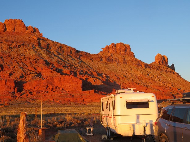
I reserved a spot at what sounded like a great RV Park (there rates certainly looked like they should be top-notch - luckily, I got a 50% Passport America discount).  However, when I got there, late in the day, I found a very tight campground with not-very-level dirt and grass sites.  The trees were so close that the manager had to help me navigate to get backed in without hitting anything. 

The sprinklers were on - spraying over both sides of the trailer!  The manager did put a bucket over one sprinkler head so that I could get in and out of the trailer without being sprayed.

How funky was this place?  My neighbor was unshaven and wearing pajama bottoms.  I was going to use their showers but after seeing the laundry room, I showered in my trailer.  I had to clean the washer/dryer before using them (I was desperate or I would have given that a miss too).  Unpainted dry-wall, bare sub-flooring, a defunct washer and hot water heater off to one side - sigh.


But, it was quiet and the managers were nice.


Then, I got the weather update!


By now, it was cooling down a lot and raining off and on.  My cell signal wasn't very good (even with my booster) but the RV park wi-fi was pretty good (that hardly ever happens!).

So, I checked out the weather on my 'Weather Bug' app and then on Television network news.  An unexpectedly strong storm system was moving in and the forecast for Yellowstone and Jackson Hole was updated to 'high temps in the mid-30's and 4-8" of snow, slippery roads - use caution'.

Oh-oh!  Not exactly great towing conditions or hiking conditions.

Plan 'C'


Well, plan 'B' had been the spontaneous idea to zip over to Yellowstone for awhile.  Plan 'C' had me turn around and head south on I-15 into Utah.  Temps look great there and I always love the scenery in Utah.  

It rained all night, I got up this morning and hooked up in the rain (not my favorite thing!).  But, it only took about a half-hour to drive out of the steady rain.  While it continued to sprinkle on/off, I could tell I was driving out of the weather system.

Since I was really flying blind at this point, I ended up in Salt Lake City during rush hour and by the time it spit me out, I had driven 300 miles and ended up in a Wal-Mart in Payson, ID.

Wheewww!  What a day!  I bought a few groceries, got a haircut and had dinner at a small Chinese restaurant within walking distance.

Highlight of the day: I saw a badger coming out of a culvert and looking around a bit myopically as I zoomed by.


Time to check the maps again and see what tomorrow brings!


I have great cell signal here - so I'll do some trip planning and then turn in early so I can beat the traffic out of here in the morning.


On the road again!

Deschutes River Recreation Area, Biggs Oregon; 8 Sept, ‘17

My trailer definitely has a sense of humor!


Twice I’ve gone back into the trailer at rest stops to discover all my plates and bowls spread out over the floor of the trailer.  This has happened before, rarely, and only after miles on really bumpy roads.  Today, I’ve driven slowly on perfectly good highway.  Who Knows?!  For now, I’m tying the cupboard doors together and I’ve put that sticky shelf liner stuff on my shopping list.   It’s always something.


Threading the needle thru the wildfires


If it’s summer, the western states are on fire.  Especially now, with 15 of the hottest, driest summers on record since 2000.  The week before I was to leave, a fierce wildfire (Eagle Creek Fire) closed I-84 E. on the North side of Mt Hood. I-84 is the major interstate going East from Portland.  Fortunately, I could take another route that would take me around the South (hwy 26) and then up the East (hwy 35) side of Mt. Hood until I could rejoin I-84E after the closure.


Smokey, smokey, smokey!!!


The drive was pretty and nostalgic.  I passed many trailheads where I have hiked and snow-shoed or cross-country skied over the years.  The smoke from the fires was sometimes thick and acrid and the going was slow due to all the long-haul truckers who were also taking this detour.  Just before Hood River, I enjoyed driving through the ‘fruit loop’, a rich agricultural area of the mountain featuring vineyards (and wineries!!) fruit tree orchards, and berry farms.

I was tempted to stop for a local hard cider – but was feeling so lazy I knew it would be hard to get moving again!


As it was, I only got about 120 miles before stopping at the Deschutes River Recreation Area Campground.  It’s a lovely grassy campground right on the Deschutes River with boat launches and moorage stations along the shore for camping fishermen.


Really easy tie-up posts for the boats - also tires or heavy carpet on the bank to protect the front of the boats.  Sweet!